Fort Foote (Prince George's County, Maryland)
Prince George's County · Maryland · American Civil War
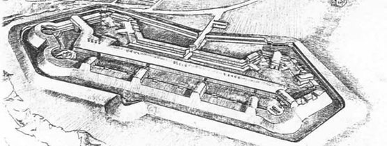
History & Significance
In the opening days of the Civil War, Washington D.C.'s defenses were primarily concerned with overland attack; in 1861 the Arlington Line was constructed to defend against Virginia approaches, and additional forts were constructed on northern approaches to defend against attacks from Maryland. Only Fort Washington, built in the War of 1812, originally blocked the Potomac River approach; its vulnerability was highlighted in the 1862 clash of the USS Monitor and CSS Virginia, and Washingtonians feared an ironclad similar to the Virginia might slip past and bombard the city.
Rosiers Bluff, a 100-foot-high Maryland cliff six miles south of the city, was found to be an excellent site for the new fort. Construction began in the winter of 1862–1863, but progressed slowly.
The four companies of the 9th New York Heavy Artillery Regiment were pressed into service as laborers under Lieutenant Colonel William H. Seward Jr., son of Secretary of State William Seward; on August 20, 1863, Seward, President Abraham Lincoln, Secretary of War Edwin Stanton, and General Barnard visited. On September 17, 1863, the fort was named in honor of Admiral Andrew H. Foote by Secretary Seward.
The fort was not completely armed until April 1865, just before Lee's final surrender, and was pronounced complete June 6, 1865, boasting two 15-inch Rodman guns, four 200-pounder Parrott rifles, and eight 30-pounder Parrott rifles. It operated from 1863 to 1878, when the post was abandoned, and was used briefly during the First and Second World Wars. The remnants of the fort are located in Fort Foote Park, maintained by the National Park Service as part of the National Capital Parks-East system.
Key Facts
Map
View larger map ↗ · © OpenStreetMap contributors
🧳 Visiting
What you’ll see when you visit:
- Preserved earthwork and timber fortifications from 1861
- Two 15-inch Rodman guns and artillery emplacements overlooking the Potomac River
- Original gun positions and defensive earthworks intact
- Potomac River vistas and river defense strategy interpretation
Sources
- https://www.nps.gov/fofo/index.htm
- https://home.nps.gov/fofo/learn/historyculture/index.htm
- https://en.wikipedia.org/wiki/Fort_Foote
- https://npshistory.com/publications/fofo/index.htm
- https://www.cultural-landscapes.org/fort-foote