Fort Kearny (Saunderstown, Narragansett, Rhode Island)
Saunderstown, Narragansett · Rhode Island · World War II
History & Significance
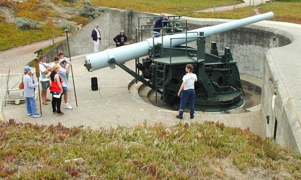
Fort Kearny was built under the Endicott Program from 1904 to 1908 as part of the Coast Defenses of Narragansett Bay. The fort was named for Major General Philip Kearny, killed in the American Civil War.
It protected the West Passage of Narragansett Bay, along with Fort Getty in Jamestown and Fort Greble on Dutch Island. The guns of Battery French were removed in 1917 for potential service on the Western Front; three guns were sent to France for use on field carriages, but sources indicate that none of the 6-inch gun regiments completed training before the Armistice and thus they did not see combat, and the guns were not returned to Fort Kearny.
In World War II a large-scale modernization of coast defenses was implemented; in Narragansett Bay this was centered on Fort Church and Fort Greene, and Fort Kearny was slated for disarmament once the new defenses were completed. In 1942 the 3-inch guns of Battery Armistead were relocated to Fort Varnum, and in 1943, with improved defenses completed, Fort Kearny's two remaining guns at Battery Cram were scrapped.
Fort Kearny was a prisoner-of-war camp in World War II, beginning in February 1945. It was the headquarters of a program to re-educate German prisoners with democratic values, one element of which was the German-language newspaper Der Ruf (The Call).
Key Facts
Map
View larger map ↗ · © OpenStreetMap contributors
🧳 Visiting
Sources
- https://en.wikipedia.org/wiki/Fort_Kearny_(Rhode_Island)
- https://fortadams.org/about/fort-adams-history/full-history/
- https://en.wikipedia.org/wiki/Harbor_Defenses_of_Narragansett_Bay
- https://smallstatebighistory.com/the-top-secret-world-war-ii-prisoner-of-war-camp-at-fort-kearney-in-narragansett/
Other Forts in Rhode Island
See all forts in Rhode Island →