Fort Loudoun (Monroe County, Tennessee)
Monroe County · Tennessee · French and Indian War
History & Significance
Fort Loudoun was a British fort located in Monroe County, Tennessee, constructed from 1756 until 1757 to help garner Cherokee support during the French and Indian War. The fort was designed by John William Gerard de Brahm, with construction supervised by Captain Raymond Demeré; the garrison was commanded by Demeré's brother, Paul Demeré.
It was named for the Earl of Loudoun, commander of British forces in North America. Relations between the garrison and local Cherokee inhabitants were initially cordial but soured in 1758 with hostilities between Cherokee fighters and Anglo-American settlers on the frontier in Virginia and South Carolina.
After 16 Cherokee chiefs held hostage at Fort Prince George were killed on February 16, the Cherokee laid siege to Fort Loudoun in March 1760, and the fort's garrison held out for several months before surrendering in August. Near Tellico Plains, approximately 700 Cherokees attacked the retreating soldiers and their families, killing three officers, 23 soldiers, and three women.
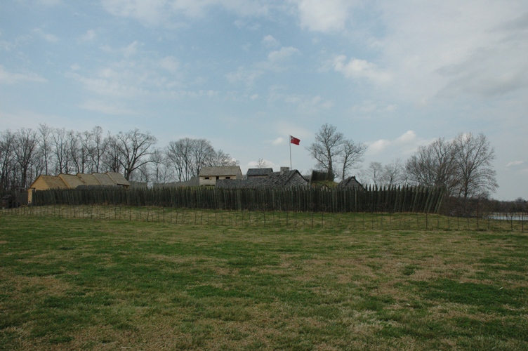
Although lost in 1760, Fort Loudoun had served its military mission of keeping the Cherokees from supporting the French cause in the early, decisive years of the war. Based on detailed descriptions by De Brahm and Demeré and Works Progress Administration excavations, the facility was reconstructed in the 1930s, with additional work supported by the Fort Loudoun Association and Tennessee Division of Archaeology in the 1970s and 1980s.
Key Facts
Map
View larger map ↗ · © OpenStreetMap contributors
🧳 Visiting
What you’ll see when you visit:
- Reconstructed 18th-century British fort with palisade walls and period buildings
- Archaeological exhibits revealing frontier life and Cherokee encounters
- Museum interpreting the 1760 siege and garrison's tragic retreat
- Scenic setting along the Tennessee River in the Smoky Mountains region
Sources
- https://en.wikipedia.org/wiki/Fort_Loudoun_(Tennessee)
- https://tennesseeencyclopedia.net/entries/fort-loudoun/
- https://tnstateparks.com/parks/info/fort-loudoun
- https://tnstateparks.com/parks/fort-loudoun
- https://fortloudoun.com/history/
- https://en.wikipedia.org/wiki/Siege_of_Fort_Loudoun