Fort Ward (Wakulla County, Florida)
Wakulla County · Florida · American Civil War
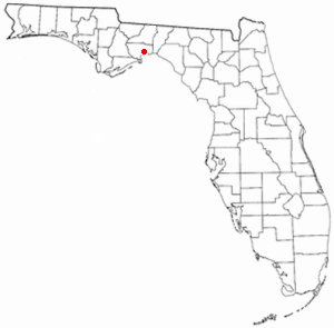
History & Significance
Named after Colonel George T. Ward, owner of Southwood Plantation, Waverly Plantation, and Clifford Place Plantation south of Tallahassee, the fort occupied a site of tremendous strategic and historical value. The Fort San Marcos de Apalache began with a wooden fort in the late 1600s, and passed through Spanish, British, and American hands before Confederate occupation in 1861.
When Confederates took control, they soon began to reconfigure the old Spanish works to suit their defensive needs, constructing earthen batteries and powder magazines. During the Civil War, Wakulla County was blockaded from 1861 to 1865 by a Union Navy squadron at the mouth of the St. Marks River.
The fort's strategic position protected the southern terminus of the Tallahassee-St. Marks Railroad, a vital supply line. The Battle of Natural Bridge eventually stopped the Union force that intended to take Fort Ward and nearby Tallahassee, the only Confederate state capital other than Austin, Texas which had not been captured.
For 100 years after the end of the Civil War, the San Marcos de Apalache fort site was in private ownership, accessible only by boat, and overgrown by vegetation. In the 1960s, Florida bought the land to turn it into the San Marcos de Apalache Historic State Park.
Key Facts
Map
View larger map ↗ · © OpenStreetMap contributors
🧳 Visiting
What you’ll see when you visit:
- Confederate artillery fort at river confluence, site of Civil War defensive operations
- Multi-era fortification history: Spanish, British, and American control
- Battle of Natural Bridge repelled Union advance
- Restored earthworks and interpretation of Wakulla River strategic position
Sources
- https://en.wikipedia.org/wiki/Wakulla_County,_Florida
- https://en.wikipedia.org/wiki/Fort_Ward_(Florida)
- https://www.trailoffloridasindianheritage.org/san-marcos/
- https://www.battlefields.org/visit/heritage-sites/fort-ward-san-marcos-de-apalache-historic-state-park
- https://grokipedia.com/page/san_marcos_de_apalache_historic_state_park
- http://www.flpublicarchaeology.org/civilwar/military-sites/fort-ward
- https://strangeandmysteriouswaters.blogspot.com/2019/02/the-civil-war-1861-1865-part-three.html