Fort Williams (Fayetteville, Alabama, Alabama)
Fayetteville, Alabama · Alabama · Creek War
History & Significance
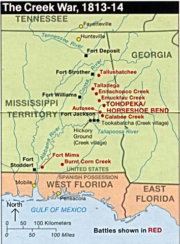
Located on the southeast shore where Cedar Creek meets the Coosa River, near Talladega Springs, Fort Williams served as the strategic midpoint in Andrew Jackson's supply-line architecture during the Creek War. The site was chosen as it was equidistant from Fort Strother to Holy Ground.
The majority of Jackson's forces were garrisoned at Fort Williams prior to the Battle of Horseshoe Bend, and blazed a 52-mile trail from the fort to the battle site. After the war, Fort Williams was used as a holding area for Creeks during the Trail of Tears as part of the Indian Removal.
An unknown number of Creeks died here due to scarce provisions and were buried in unmarked graves in the adjacent cemetery. The Fort Williams Cemetery was added to the Alabama Register of Landmarks and Heritage on May 12, 1976. The headstones from the military cemetery were relocated from their original site in 2006 due to the development of a neighborhood.
Key Facts
Map
View larger map ↗ · © OpenStreetMap contributors
🧳 Visiting
Sources
- https://en.wikipedia.org/wiki/Fort_Williams_(Alabama)
- https://www.battlefields.org/learn/articles/creek-war-1813-1814
- https://encyclopediaofalabama.org/article/creek-war-of-1813-14/
- https://www.hmdb.org/m.asp?m=57761
- https://www.sylacauganews.com/local/historic-marker-series-fort-williams
- https://fortwiki.com/Fort_Williams_(3)