Fort Foster (Kittery, Maine)
Kittery · Maine · Early 20th Century Coastal Defense
History & Significance
The federal government acquired the land in 1872, but construction of Fort Foster did not begin until 1898 in response to the Spanish-American War. Built as part of the large-scale Endicott Program for modernized harbor defense, the fort was completed in 1901 and named for Major General John G. Foster, a Union Army officer from New Hampshire.
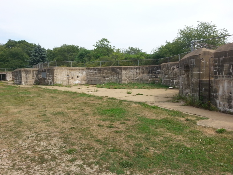
The installation consisted of two primary batteries: Battery Bohlen, built 1898–1901 with three 10-inch M1895 disappearing guns, and Battery Chapin, completed in 1904 with two 3-inch M1902 guns. It served as a sub-post of Fort Constitution and coordinated with Fort Stark as part of the Harbor Defenses of Portsmouth command.
During World War I, the 10-inch guns were temporarily removed for potential conversion to railway artillery but returned in 1919 after the armistice. World War II brought significant expansion, including new mine control facilities, anti-motor torpedo boat batteries, and an incomplete 6-inch gun battery begun in 1942.
The fort remained operational until 1946, with final closure in 1948. All weapons were subsequently scrapped. The Navy then used the site for personnel recreation until the early 1960s, when the Town of Kittery acquired the property for public park use.
Key Facts
Map
View larger map ↗ · © OpenStreetMap contributors
🧳 Visiting
What you’ll see when you visit:
- Disappearing gun batteries and fire control tower from Endicott Program era
- Mine casemate structures from coastal defense operations
- Sandy beaches and walking trails on Gerrish Island
- Early 20th-century fortifications active through World War II
Sources
- https://en.wikipedia.org/wiki/Fort_Foster_(Kittery,_Maine)
- https://www.northamericanforts.com/East/Maine/Fort_Foster/history.html
- https://en.wikipedia.org/wiki/Harbor_Defenses_of_Portsmouth
- https://www.hmdb.org/m.asp?m=185012