Fort John Custis (Townsend, Virginia)
Townsend · Virginia · World War II
History & Significance
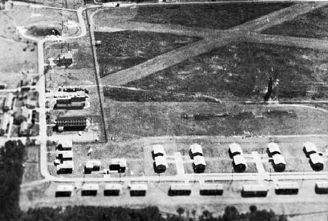
Established in 1941 as Fort Winslow at the southern tip of Virginia's Eastern Shore, this coastal artillery installation was designed to complement Fort Story in protecting the wide entrance of Chesapeake Bay against enemy warships as part of the Harbor Defenses of Chesapeake Bay. Briefly renamed Fort Custis, the post was redesignated Fort John Custis in October 1942 to avoid confusion with Fort Eustis in Newport News, honoring John Parke Custis, son of Martha Washington and a Revolutionary War officer.
Following American entry into World War II, a four-gun battery of 155 mm guns was deployed on nearby Fisherman Island, supplemented by two 6-inch gun batteries completed in 1943, while the 1st Battalion, 52nd Coast Artillery Regiment arrived with eight 8-inch ex-Navy railway guns in August 1942. The main fortification, Battery 122 (Battery Winslow), housed two casemated 16-inch ex-Navy guns positioned to create a crossfire with batteries at Fort Story.
At least ten fire control towers were built across the Eastern Shore, with three remaining on Smith Island near the Cape Charles Lighthouse and two on Mockhorn Island, plus additional towers on the mainland and at Wise Point. The Army closed Fort John Custis in 1948.
In 1950, the U.S. Air Force acquired the site and renamed it Cape Charles Air Force Station, constructing radar towers and buildings until 1981. Since 1984 the site has been incorporated into the Eastern Shore of Virginia National Wildlife Refuge.
Key Facts
Map
View larger map ↗ · © OpenStreetMap contributors
🧳 Visiting
What you’ll see when you visit:
- WWII-era coastal artillery fort with 16-inch naval guns and 6-inch gun emplacements
- Concrete bunkers and fortifications overlooking Chesapeake Bay
- Part of Eastern Shore of Virginia National Wildlife Refuge with beach and wetland habitat
- Defensive crossfire position paired with Fort Story across the bay
- Historic fortification system protecting strategic waterway during wartime
Sources
- https://en.wikipedia.org/wiki/Cape_Charles_Air_Force_Station
- https://www.mountvernon.org/library/digitalhistory/digital-encyclopedia/article/john-parke-custis
- https://www.northamericanforts.com/East/Virginia/Fort_Custis/history.htm
- https://www.fws.gov/refuge/eastern-shore-virginia/about-us
- https://encyclopediavirginia.org/entries/custis-john-parke-1754-1781/